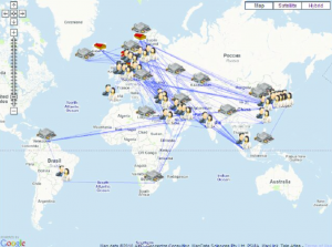
The development of autonomous vehicles has received considerable attention in the technology press lately. So far this hasn’t translated into a lot of interest from the geospatial sector, despite this emerging technology’s reliance on geographic data. This article examines self-driving cars from the perspective of the geospatial industry, it examines the technology’s requirements for hugely detailed geographic data and suggests novel methods that technology firms could use to meet these demands, some of which could have a potentially disruptive impact on the geographic information industry.
As this advert from 1957 demonstrates self-driving cars are a long held dream. A dream that, until now, has repeatedly failed to materialise. This is set to change. Catalysed by the rapid advancements in, and falling costs of, computing power and sensor technology. Along with a big push from DARPA (Defence Advanced Research Projects)1, autonomous vehicles are no longer a futuristic concept, they are a reality. Google’s autonomous cars have driven safely for more than 700,000 miles2; Nissan have revealed they are planning to release a driverless car by 20203 and the newest Tesla will include a feature that will allow drivers to summon their cars to meet them at a prearranged spot4 (for use only on private property, for now). The technology is attracting interest from government’s worldwide; the Chinese government has sponsored six driverless car competitions5; while the UK government has also offered funding and regulatory reform6. Meanwhile the list of major companies in the autonomous vehicle race is ever growing. At the time of writing Wikipedia listed 12 major companies and research organizations that have developed working prototypes7.
No one knows for sure when this technology will replace the average driver but the consensus seems to be for a vehicle market dominated by autonomous vehicles in around 20 years. Of the educated guesses available: ABI Research predict 50% of new vehicles will be autonomous by 2032, Navigant Research predict sales of autonomous vehicles to reach 75% by 2035 and Morgan Stanley predict 100% market penetration by 20468 (global car sales 2013: 68.69 million units9). The safety benefits are the most widely touted at this early stage (Volvo target zero deaths by 202010), but it is the savings in time, money and carbon that a more efficient and less congested transport system would provide that make up the biggest wins. Wins that led Morgan Stanley to predict vehicle autonomy will contribute $5.6 trillion in annual economic savings globally11.
Currently the self-driving car world is split into two camps. Companies that want to use automation to make drivers safer and more efficient through ‘driver assisted technology’ and companies that want to replace human drivers entirely through full vehicle autonomy. The most high profile advocate of full autonomy is the intrinsically disruptive Google. Full autonomy is disruptive because it allows the possibility of Shared Autonomous Vehicles (SAV). Networks of self-driving taxis on demand. University of Texas Austin have produced models of the impacts of SAVs and found with just 5% penetration every SAV on the road would replace 11 conventional vehicles12. Google have shown their SAV ambitions by developing a demonstration fleet of shared autonomous golf carts13; releasing a fully autonomous prototype14 (no steering wheel); and, perhaps most convincingly of all, investing $258 million in the ridesharing app Uber15.
Google’s approach also differs in another key area, they completely reject vehicle to vehicle, or vehicle to infrastructure communication, in favour of fully self-contained vehicles. As Google product lead Anthony Levandowski explained their car needs to be able to operate just fine on the roads as-is, without relying on any new infrastructure, because “the first person that has this should be able to get benefits16.”
It is Google’s solution to the challenge of a fully autonomous and entirely self-contained vehicle that is of significant interest to the Geographic Information industry because to achieve this Google’s cars must be pre-loaded with detailed maps of the areas they will travel in.
“Everywhere the vehicle drives we’ve mapped ahead of time to about 11cm resolution.17”
Chris Urmson, Director, Google Self-Driving Car Project
“We tell it how high the traffic signals are off the ground, the exact position of the curbs, so the car knows where not to drive.18”
Andrew Chatham, Mapping Lead, Google Self-Driving Car Project
The need for a highly detailed map of most of the world’s road network is a formidable challenge for any organisation, but Chris Urmson, Google’s Project Director, has downplayed the difficulty, variously describing it as “work, but not intimidating work17” and stating “we know how to deal with that scale of data12”.
Many in the GI industry who have first-hand experience of the sisyphean task of maintaining up to date spatial data infrastructures, of considerably lower resolutions than those required by self-driving cars, may detect hubris in Google’s attitude. But Google do have impressive form when it comes to data. We’ve seen before with Google’s street view successes (a programme incidentally designed by some of the same people now in charge of the autonomous vehicle programme19) that Google are not shy about undertaking large scale data collection exercises and we know they have the cash to deliver20.
Clearly one implication for the GI industry of the need for such a map is that there will be a new and significant source of demand for high resolution geospatial information, but the way in which this data may be derived will also have implications for the supply of geospatial data.

This image shows the sensors that will be present in Google’s autonomous vehicles. A whole array of sophisticated sensors: LiDAR, radar, cameras and position estimators. Note no GPS receiver is listed, the cars will have them, but won’t rely on them for navigation. This is because GPS requires communication with external infrastructure, which is not always reliable, and violates Google’s design principles. Instead the cars use the information derived from the sensors to track the car’s position on the pre-loaded digital map of the area they are travelling through and to identify features that are not on the map, including crucially other vehicles.
A crucial element of the system that the car uses to identify features that it encounters is called Simultaneous Location and Mapping, or SLAM. This is a technique used in robotics in which a robot builds a map of a foreign environment in order to orientate itself within it. SLAM is already being used for automated surveying. A company called 3D Mapping is currently marketing the ZEB1, a lightweight backpack which uses Lidar and 3D SLAM to automatically map areas without reliable GPS signals such as mine shafts21. Google are also deploying SLAM devices to update their mapping. In September 2014 Google announced the Cartographer. A back pack equipped with 2 multi-echo laser scanners that uses SLAM to map the interiors of buildings such as shopping centres22.
Current SLAM mapping technology still requires manual input to identify the features mapped by the devices. However this step may also soon be automated. 510 Systems, the start-up that Google acquired to develop the autonomous car project in 2011, had, prior to being acquired by Google, developed an automated system for utility companies to survey overhead cables23. In 2011 when talking about the process of building the first set of maps needed to operate the prototype vehicles Chris Urmson spoke about the algorithmic and machine learning work that the self-driving car project had done to pull features out of the road without having to click through the data by hand18. And Google aren’t the only mapping company working on automatic feature recognition. This slide is taken from an Australian research project looking into the automated identification of road features24.
Whether or not Google will be the first company to master automated surveying they are currently the only mapping data company that has a fleet (which could one day be potentially millions strong) of automated vehicles fitted with a sophisticated array of surveying equipment with a track record of crowdsourcing spatial data.
Google’s record of crowdsourcing spatial data refers to Waze, a $966 million, July 2013, Google acquisition25. Waze uses multiple GPS traces, crowd sourced from GPS receivers used by in-car navigation devices, to map road locations and turn restrictions.
Automation is part of Google’s mapping strategy. This is demonstrated by their recent patent for automatically locating the position of roads using satellite data26 (combined with their acquisition of Skybox imaging, a satellite company27). Crowd sourcing data is also part of the Google strategy, as demonstrated by the Waze acquisition. Meanwhile SLAM enabled devices are likely to have ever increasing applicability in surveying, as demonstrated by the ZEB1 and Cartographer backpacks. Whether autonomous vehicles will combine all these trends into one ubiquitous automated surveying device remains to be seen.
If the cars can be used as surveying devices then they have the potential to be a hugely powerful tool. Not only are they fitted with sophisticated sensors capable of collecting huge amounts of data, but they also have the necessary artificial intelligence to filter that data at source into meaningful topographic information. The prospect is a highly detailed dataset that is current along all navigable routes. The obvious market for such a dataset is the automated vehicle market itself, which will use this data to navigate and for traffic optimisation. Then there are the potential spin off markets, such as transport asset management and transport planning. Such a dataset would also present a threat to the business models of existing data collection agencies, such as survey companies and national mapping agencies, and present a whole host of questions. The safety and efficiency of the transport network would rely on the most up to date and detailed dataset being as widely available as possible. Who will control this dataset? And that’s without mentioning the ever looming privacy implications.
Published 1st December 2014 by Philip Knight, Senior Consultant, ConsultingWhere
1. DARPA Grand Challenge. Wikipedia. Available at: http://en.wikipedia.org/wiki/DARPA_Grand_Challenge
2. Google’s Self-Driving Cars Still Face Many Obstacles. MIT Technology Review, August 2014. Available at: http://www.technologyreview.com/news/530276/hidden-obstacles-for-googles-self-driving-cars/
3. Nissan Plans to Offer Driverless Cars by 2020. Mashable, August 2013. Available at: http://mashable.com/2013/08/27/nissan-plans-to-offer-driverless-cars-by-2020/
4. Tesla Model S gains Autopilot, all-wheel-drive option. CNet, October 2014. Available at: http://www.cnet.com/uk/news/tesla-model-s-gains-autopilot-all-wheel-drive-option/
5. Driverless cars compete in China. BBC News. November 2014. Available at: http://www.bbc.co.uk/news/world-asia-30077682
6. UK Government Fast Tracks Driverless Cars. July 2014. Available at: https://www.gov.uk/government/news/uk-government-fast-tracks-driverless-cars
7. Autonomous Cars. Wikipedia. Available at: http://en.wikipedia.org/wiki/Autonomous_car
8. Everyone Will Have Self-Driving Car By 2026, Analyst Says. Huffington Post, February 2014. Available at: http://www.huffingtonpost.com/2014/02/27/morgan-stanley-autonomous-cars-prediction_n_4867613.html
9. Global Auto Report. Scotia Bank, September 2014. Available at: http://www.gbm.scotiabank.com/English/bns_econ/bns_auto.pdf
10. Volvo Vision 2020. Available at: http://www.unece.org/fileadmin/DAM/trans/roadsafe/unda/Sweden_Volvo_Vision_2020.pdf
11. Morgan Stanley Analysts Believe Autonomous Cars Will Transform the Auto Industry, Boost the Economy. Morgan Stanley Report, Nov 2013. Available at: http://www.morganstanley.com/public/11152013.html
12. Imagine: A World Where Nobody Owns Their Own Car. CityLab, February 2014. Available at: http://www.citylab.com/commute/2014/02/imagine-world-where-nobody-owns-their-own-car/8387/
13. Google’s Self-Driving Golf Carts, IEEE Spectrum Conference. Youtube, October 2011. Available at: https://www.youtube.com/watch?v=rOWhu_aa9kM
14. Just press go: designing a self-driving vehicle. Google Blog, May 2013. Available at: http://googleblog.blogspot.co.uk/2014/05/just-press-go-designing-self-driving.html
15. Google and Uber Could Transform America. Slate, August 2013. Available at: http://www.slate.com/articles/business/moneybox/2013/08/google_s_uber_investment_autonomous_cars_and_smartphone_taxes_are_a_game.html
16. Silicon Valley Autonomous Vehicle Enthusiasts talk by Anthony Levandowski of Google. iTunes Podcast, October 2013. Available at: https://itunes.apple.com/us/podcast/5.-anthony-levandowski-google/id672410323?i=168818258&mt=2
17. The Trick That Makes Google’s Self-Driving Cars Work. The Atlantic, May 2014. Available at: http://www.theatlantic.com/technology/archive/2014/05/all-the-world-a-track-the-trick-that-makes-googles-self-driving-cars-work/370871/
18. How Google’s Self-Driving Car Works, IEEE Spectrum Conference. Youtube, October 2011. Available at: https://www.youtube.com/watch?v=YXylqtEQ0tk
19. Auto Correct. The New Yorker, November 2013. Available at: http://www.newyorker.com/magazine/2013/11/25/auto-correct
20. Google’s Expected $100 Billion Cash Pile Prompts Call for Dividend. WSJ.D Tech. November 2014. Available at: http://blogs.wsj.com/digits/2014/11/01/googles-expected-100-billion-cash-pile-prompts-call-for-dividend/
21. ZEB1: Hand-held Mobile Mapping. Available at: http://www.3dlasermapping.com/products/handheld-mapping
22. Google Unveils The Cartographer. TechCrunch, September 2014. Available at: http://techcrunch.com/2014/09/04/google-unveils-the-cartographer-its-indoor-mapping-backpack/
23. The Unknown Start-up That Built Google’s First Self-Driving Car. IEEE Spectrum. November 2014. Available at: http://spectrum.ieee.org/robotics/artificial-intelligence/the-unknown-startup-that-built-googles-first-selfdriving-car/
24. Current Research Trends from an Australian Perspective. Collier Philip, 2014. Available at: http://www.indiageospatialforum.org/2014/proceedingPDF/Emerging%20trend/Philip%20Collier.pptx.pptx.pdf
25. Google reveals it spent $966 million in Waze acquisition. CNet, July 2013. Available at: http://www.cnet.com/uk/news/google-reveals-it-spent-966-million-in-waze-acquisition/
26. Updating map data using satellite imagery. US Patent US 8731305 B1. Available at: http://www.google.com/patents/US8731305
27. Google Unearths a Deal with Skybox. Wall Street Journal, June 2014. Available at: http://online.wsj.com/articles/amid-stratospheric-valuations-google-unearths-a-deal-with-skybox-1402864823